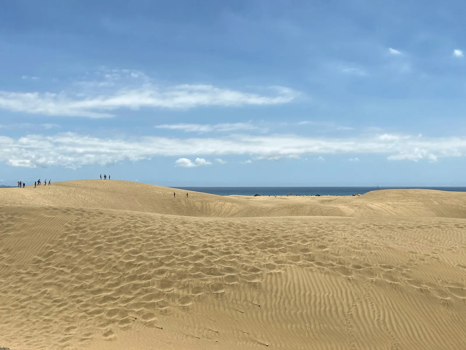
The dunes are a protected nature reserve about 13 km east of Arguineguín: bus 90 takes you to the lighthouse end, a car takes about 16 minutes. Stay on the marked routes, go in the morning, and do not treat sunset as a free-for-all.
The Maspalomas dunes are an easy day out from Arguineguín: about 13 km east by road (roughly 16 minutes without traffic), or one direct bus, Global line 90, to the Faro de Maspalomas stop by the lighthouse. They are not a beach playground but a protected nature reserve of more than 400 hectares, and the one rule that matters is to stay on the marked routes. Go in the morning for cooler air, softer light and far fewer people than at sunset.
This page covers the practical side from Arguineguín: which bus, which end of the dunes to start from, what the reserve's rules mean in practice, and when to go. For the wider area around the dunes (Meloneras promenade, the lighthouse, Playa del Inglés) see Maspalomas and Meloneras from Arguineguín.
What the dunes are, and what you are allowed to do there
The area is a Reserva Natural Especial: a sea of pale sand that runs from the Playa del Inglés side down to the lighthouse and the long Maspalomas beach, with a palm oasis and a small lagoon at the western end. The Cabildo (the island government) manages it, and it says so loudly. According to Canarian broadcaster RTVC (July 2026), thousands of people visit every day, many of them tourists, and the worst trouble comes at sunset, when crowds climb into restricted parts of the dune system for photographs.
The Cabildo's answer has been surveillance rather than a gate. Drones, cameras, sensors, new signs and a solar-powered 4G loudspeaker have been added, and the environment councillor has said the island cannot be run on the back of Instagram pictures. The same reporting puts the number of people straying into restricted zones at 150 to 300 on a busy evening. Fines of several hundred euros have been issued for offences in protected areas, and a reported 2026 case reached the €600 maximum for that offence.
In practice, that means:
- Walk on the marked routes and the beach, and obey the signs and the patrols' instructions.
- Do not wander onto the untouched crests to photograph them. The ripples and crescents are exactly what the reserve exists to protect.
- Do not build stone figures or write names in the sand.
- No camping and no fires.
- Take your rubbish with you.
Rules on dogs and the exact limits of the restricted zones are the Cabildo's to set, so read the signs at the entrance you use rather than relying on this page.
By bus from Arguineguín
Global's line 90 (Telde – airport – Faro de Maspalomas – Arguineguín – Playa del Cura) stops in Arguineguín between the Casa Memo and Sunwing stops and serves the Estación Faro de Maspalomas. Take it in the direction of Maspalomas and Telde. On Global's page the first bus from Playa del Cura leaves at 08:00 and the last at 22:00, roughly hourly; those are times at the start of the line, so Arguineguín comes a little later. Global gives no journey time for the stretch to the lighthouse, so allow about half an hour and check on the day.
The alternative is line 39 to Playa del Inglés (weekdays, hourly, from about 09:45 at Playa del Cura) or line 33 (Saturday and holiday timetable 09:25 to 17:55, about every 30 minutes). Playa del Inglés puts you at the eastern edge of the dunes, so you can walk through them towards the lighthouse and pick up line 90 at the other end. Whichever you choose, the full list of lines and how to pay is on buses in and from Arguineguín.
Dunes by bus, one way through. Ride to Playa del Inglés, walk the marked route towards the lighthouse with a stop on the beach, and take line 90 home from the Faro de Maspalomas stop. That way you never retrace your steps and you see the whole length of the reserve. Check the last bus on the Global line page before you set off.
By car or taxi
The Faro de Maspalomas is about 13 km from Arguineguín, or around 16 minutes in free-flowing traffic. Parking near the lighthouse and along the beach fills early on sunny days, and no figure for parking charges there is published, so arrive before 10:00 if you can. A taxi is easy at the lighthouse for the return leg; for rates and what to expect, see taxis in Arguineguín. If you plan a long day, parking in Arguineguín and the distances and travel times page cover the rest.
Which end to start from
| Start point | How you get there from Arguineguín | Good for |
|---|---|---|
| Faro de Maspalomas (lighthouse) | Line 90, or car about 16 minutes | The beach, the lagoon, a short loop, easy return by bus |
| Playa del Inglés edge | Lines 39 or 33, then walk | A one-way crossing towards the lighthouse |
| Meloneras side | Car, or on foot along the seafront from the lighthouse | Combining the dunes with a seafront promenade and lunch |
If you only have a couple of hours, the lighthouse end is the sensible choice. If you want the full dune landscape, allow two to three hours for a proper walk with stops, and carry water.
The best time to go
Time of day. Early morning is best. The light is low and the shadows show off the ripples, the sand is cool underfoot and the sunset crowd has not arrived. By midday the sand gets very hot, there is no shade in the dunes themselves, and a sun hat is not optional. Read sun, heat and UV on Gran Canaria before a summer visit.
Sunset. It is the most photographed hour and the hour with the most offences, so expect crowds and patrols. If you go, treat it as a beach-and-promenade evening and stay on the marked ground; do not climb for the picture.
Time of year. The south is dry and sunny most of the year; the nearest official climate data, from Gran Canaria airport on the east coast (AEMET, 1981–2010), shows July and August as the hottest and sunniest months, with almost no rain, and the south-west is usually sunnier and calmer than that east-coast station. Winter days are mild, and calima, the hazy Saharan dust, is most often a December to March event; see calima: when the Sahara dust arrives. A hazy sky flattens the dunes for photography and is worth knowing about before you plan a special trip.
The beach beside the dunes
Maspalomas beach and Meloneras are among the Gran Canaria beaches on the 2026–27 Blue Flag list (ADEAC), which is not true of any beach in Mogán, the municipality Arguineguín belongs to. That is a fact about the list, not a promise about sea conditions on the day: follow the flag colours, watch for jellyfish, and read beach safety on the south coast. Lifeguard hours are not published beach by beach, so check the flag at the beach rather than assuming cover.
What to bring, and how to fit it into a day
- Water, at least a litre each, plus a hat and sunscreen.
- Footwear you can walk in. Sand shoes are fine; in midsummer the surface can burn bare feet.
- A small bag for your own rubbish.
- Your bus card or enough cash and a bank card for the driver.
The dunes pair naturally with lunch in Meloneras or with a different kind of day, such as Palmitos Park or a water park, since all of these lie on the same stretch of coast. More ideas are in the best day trips from Arguineguín and day trips by bus. For a second view of the reserve, see our sister site's page on the Maspalomas dunes at Canary Guide.
Frequently asked questions
How far are the Maspalomas dunes from Arguineguín?
The Faro de Maspalomas is about 13 km from Arguineguín by road, around 16 minutes without traffic. Global bus line 90 also runs there, with no change needed.
Is there an entrance fee or a booking system for the dunes?
The reporting on the 2026 protection measures describes patrols, cameras and signs, not a gate or a quota. Check the signs at the entrance you use for any local rule.
Can you walk anywhere on the Maspalomas dunes?
No. The dunes are a Reserva Natural Especial, and the Cabildo has restricted zones inside it. Stay on the marked routes and the beach, and do not climb the untouched crests.
What is the best time of day to visit the dunes?
Early morning, when it is cool and quiet. Sunset is the most crowded and the most heavily patrolled time, and midday is hot with no shade.
Can I take the bus from Arguineguín to the Maspalomas dunes?
Yes. Take Global line 90 to the Faro de Maspalomas stop, or lines 39 or 33 to Playa del Inglés and walk in. Timetables differ on weekdays, Saturdays and holidays, so check the line page.
Are the Maspalomas beaches Blue Flag?
Maspalomas and Meloneras are on the 2026–27 Blue Flag list for Gran Canaria. No beach in Mogán is, including those at Arguineguín.
Sources
- RTVC – Maspalomas dunes under pressure from visitors in protected zones (7 July 2026)
- RTVC – surveillance of the Maspalomas dunes (26 August 2025)
- RTVC – more than 220 offences in Gran Canaria's natural areas (23 June 2026)
- Global – line 90 Telde – Faro de Maspalomas: route and timetable
- Global – line 39 Playa del Inglés – Playa del Cura
- ADEAC / Blue Flag – 2026–27 awarded beaches
- AEMET – climate normals, Gran Canaria Airport (nearest published station)