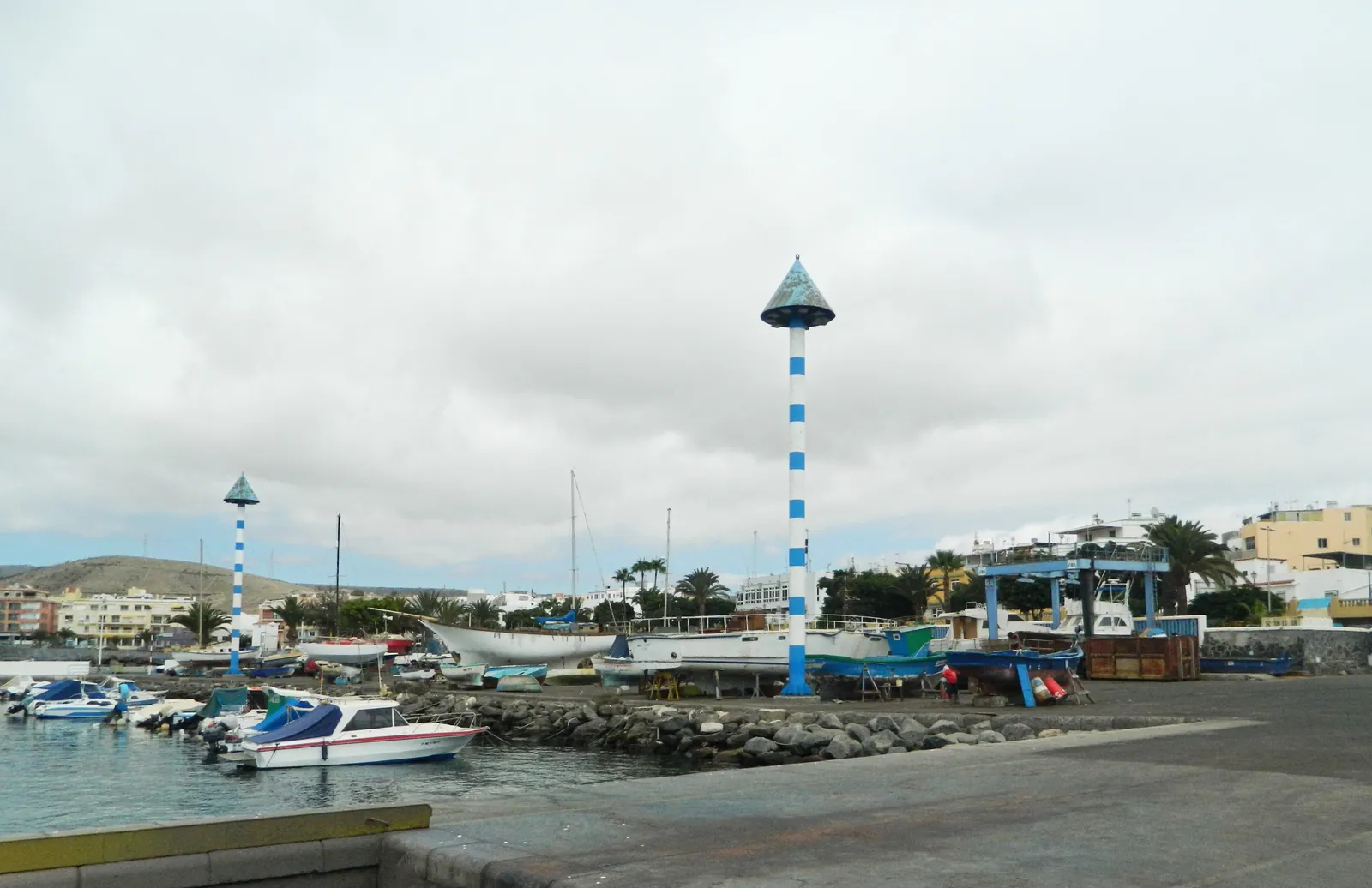
Arguineguín is small enough to walk end to end in about half an hour: a working harbour and beaches at the bottom, shops along the main road, flats on the slopes above.
Arguineguín is a compact town on a slope. The harbour sits at the bottom, the town beach and the market squares are within a few minutes of it, the coast road (the GC-500) and the main bus stop run through the middle, and the streets climb gently inland from there. Everything most visitors need, from the sea to the supermarket to the health centre, is inside a 15-minute walk of the harbour. Patalavaca, the next resort along the coast, begins about half an hour away on foot.
This page is a text map: what is where, how the parts of town feel, and how long it takes to get between them. Where to sleep is a separate question, answered in where to stay in Arguineguín.
The shape of the town in one paragraph
Stand at the harbour with your back to the sea and the town fans out in front of you. To your right (east) the town beach sits tucked behind the harbour works. Straight ahead, a few streets of shops, cafés and flats run uphill to the coast road. To your left (the north-east coast) the built-up area carries on along the seafront past the little Lajilla headland, then through the Sunwing hotel area into Patalavaca and, beyond it, Anfi del Mar. Inland, on the hillside, are the quieter residential neighbourhoods. Walking times are in the table further down.
The harbour and the old fishing quarter
The Puerto de Arguineguín is the oldest part of the town's character and still its centre of gravity. Mogán's tourism office calls it the largest fishing port in Gran Canaria, and it is also where the passenger boats to Anfi, Puerto Rico and Puerto de Mogán leave from. Around it you find the Cofradía de los Pescadores restaurant, the fishmonger's, and the lanes of low houses that were the village before the resorts arrived.
It is a working place, not a postcard: fuel, ice, nets, gulls. For what the cooperative does and how to watch the boats, see the fishing harbour and the Cofradía; for the boats that carry passengers, see boats from Arguineguín.
The beaches along the front
Mogán's official beach pages list three beaches in or beside the centre:
| Beach | Length and sand | What the council lists |
|---|---|---|
| Perchel (the town beach) | 220 m, golden and black sand | Calm water, a tidal pool, step-free access, toilets, showers, playground, bars; no lifeguard listed |
| Las Marañuelas | 279 m, dark sand | Calm water, toilets, showers, lifeguard, sunbed and water-sports hire |
| Costa Alegre | 55 m, sand and gravel behind a breakwater | Calm water, toilets, showers, restaurants |
Costa Alegre is the small beach many people know as La Lajilla; that is a local name, not the official one. The three are covered one by one in the Arguineguín town beach guide and the Costa Alegre page. None of Mogán's beaches holds a Blue Flag for 2026–27; the flag is held by the marinas at Puerto de Mogán and Pasito Blanco.
The market squares and the middle of town
The Tuesday market is the town's biggest weekly event and takes over two squares close to the seafront: Plaza Negra (municipal and flea markets) and Plaza de las Marañuelas (crafts). The Marañuelas square is only a couple of minutes from the harbour, so on a Tuesday the whole lower town is busy from 08:30. Details are in the Tuesday market guide.
The commercial streets run behind the front: Calle Alonso Quesada, Calle Viera y Clavijo and the streets around them have the bars, the pharmacies and the small shops. Two shopping centres anchor the upper part of town: La Marea, on Calle Damasco, and the Áncora centre on Calle Tamarán, where several restaurants sit under one roof. Supermarkets, fresh fish and local products are covered in the shopping guide.
The coast road, the bus stop and the health centre
The main road through town is the GC-500. Global's anchor stop for Arguineguín is Casa Memo, on that road, roughly 500 m from the harbour on foot. Lines 91, 90, 33 and 39 call in the town, and the neighbouring stops are named Sunwing and Patalavaca. The exact bus-stop positions are not published by Global, so check your line in buses in and from Arguineguín before you go.
The Centro de Salud is on Calle Damasco, next to La Marea, in the upper part of town and about 10 minutes from the harbour. It is the public health centre and has an emergency service; for current urgent-care hours, check with the centre or call 112 in an emergency. Pharmacies, private clinics and what to do when ill are in the health guide.
The seafront towards Patalavaca
Walk north-east from the harbour and the front becomes a promenade of apartment blocks, small restaurants and the Lajilla headland. The Norwegian seamen's church stands on Calle La Lajilla, and a little further on you pass the Sunwing hotel on Avenida Los Canarios. There is no sign saying where Arguineguín ends and Patalavaca begins; the built-up coast simply carries on. Most people treat the Sunwing stretch as the hinge.
Patalavaca itself is a quieter strip of apartments and restaurants around a 303 m dark-sand beach, described in the Patalavaca guide. The coast path between the two is covered in coastal walks to Patalavaca and Anfi, and beyond it lies Anfi del Mar.
The hills above town
Inland and uphill is the residential Arguineguín: blocks of flats and houses on the slope, with views back over the bay. Loma Dos, one of these neighbourhoods, is often mentioned by long-stay visitors for its sun and views; the price is the climb back up from the sea, which you notice with shopping bags. If you are comparing a flat on the hill with one near the harbour, the trade-off is quiet and views against a longer, steeper walk to everything else.
East of town: the municipal boundary and the cement works
A short way east, the municipality changes. El Pajar, Santa Águeda and Pasito Blanco belong to San Bartolomé de Tirajana (the Maspalomas municipality), not to Mogán. The cement plant and its port are on that side, which is why news reports call it "the Arguineguín cement works" even though it is not in the town proper. Its status and the legal dispute over the port are on the cement works page, and the villages on that side of the boundary are in El Pajar and Santa Águeda.
Walking times from the harbour
These are estimates at an easy pace, rounded up for crossings and slopes. Allow longer with children, heat or shopping.
| From the harbour to… | Approximate walk | Notes |
|---|---|---|
| Plaza de las Marañuelas | 2–3 minutes | Craft market on Tuesdays |
| Perchel town beach | 3–5 minutes | Flat |
| Casa Memo bus stop (GC-500) | 6–8 minutes | Slight climb |
| La Lajilla and the Norwegian church | 8–10 minutes | Along the front |
| Centro de Salud and La Marea (Calle Damasco) | 10–15 minutes | Uphill |
| Sunwing hotel | 15–20 minutes | Along the front |
| Patalavaca beach | About 30 minutes | Coast path |
| Anfi del Mar | About 40–45 minutes | Coast path, some steps |
Arguineguín harbour as your fixed point. Orient yourself from the harbour and the sea: the sea is south-east, the town climbs to the north-west, and the coast path to Patalavaca leaves along the front. If you get turned around, walk downhill until you meet the water.
How the areas feel
The harbour end is the liveliest by day and quiet after dark, apart from restaurant terraces. The streets behind it are everyday Spanish life with visitors threaded through: pharmacies, bakeries, bars where locals read the paper. The seafront towards Patalavaca is calmer and more residential. The hills are the quietest of all. Nightlife in the town is modest, a few bars and terraces rather than a strip, and anyone wanting more usually goes along the coast; comparing Arguineguín with Puerto Rico and Puerto de Mogán helps with that decision. For why the town draws so many winter regulars from Norway and Sweden, see the Scandinavian community.
Frequently asked questions
How big is Arguineguín?
Small. It has about 2,300 inhabitants, and the walk from the harbour to the upper edge of town takes 15 minutes or so. The walk to neighbouring Patalavaca takes around 30 minutes.
Where is the centre of Arguineguín?
Around the harbour and the Plaza de las Marañuelas, where the Tuesday market, the town beach and the fishing port all meet. The main road, the GC-500, runs through the middle of town a few minutes uphill.
Is Arguineguín walkable?
Yes. The harbour, beach, market squares, shops and bus stop are within about 10 minutes of each other. The upper residential streets are on a slope, so expect a climb coming back from the sea.
Where is the bus stop in Arguineguín?
Global's main stop for the town is Casa Memo, on the GC-500. The neighbouring stops are Sunwing and Patalavaca, and lines 91, 90, 33 and 39 call at Arguineguín.
Where does Arguineguín end and Patalavaca begin?
There is no marked boundary. The built-up coast continues past the Sunwing hotel into Patalavaca, which is about 30 minutes' walk from the harbour.
Is the cement works in Arguineguín?
The plant and its port are at Santa Águeda, just east of Arguineguín, which belongs to San Bartolomé de Tirajana rather than Mogán. News reports still call it the Arguineguín cement works.
Sources
- Mogán tourism – the municipality's official beach pages (Perchel, Las Marañuelas, Costa Alegre, Patalavaca)
- Mogán tourism – the Guild of Arguineguín and the port
- Mogán tourism – health centres and pharmacies in Arguineguín
- Mogán tourism – Arguineguín municipal market
- Global – line 91 stops in Arguineguín
- Puertos Canarios – Puerto de Arguineguín
- ADEAC Blue Flag – 2026–27 beach list