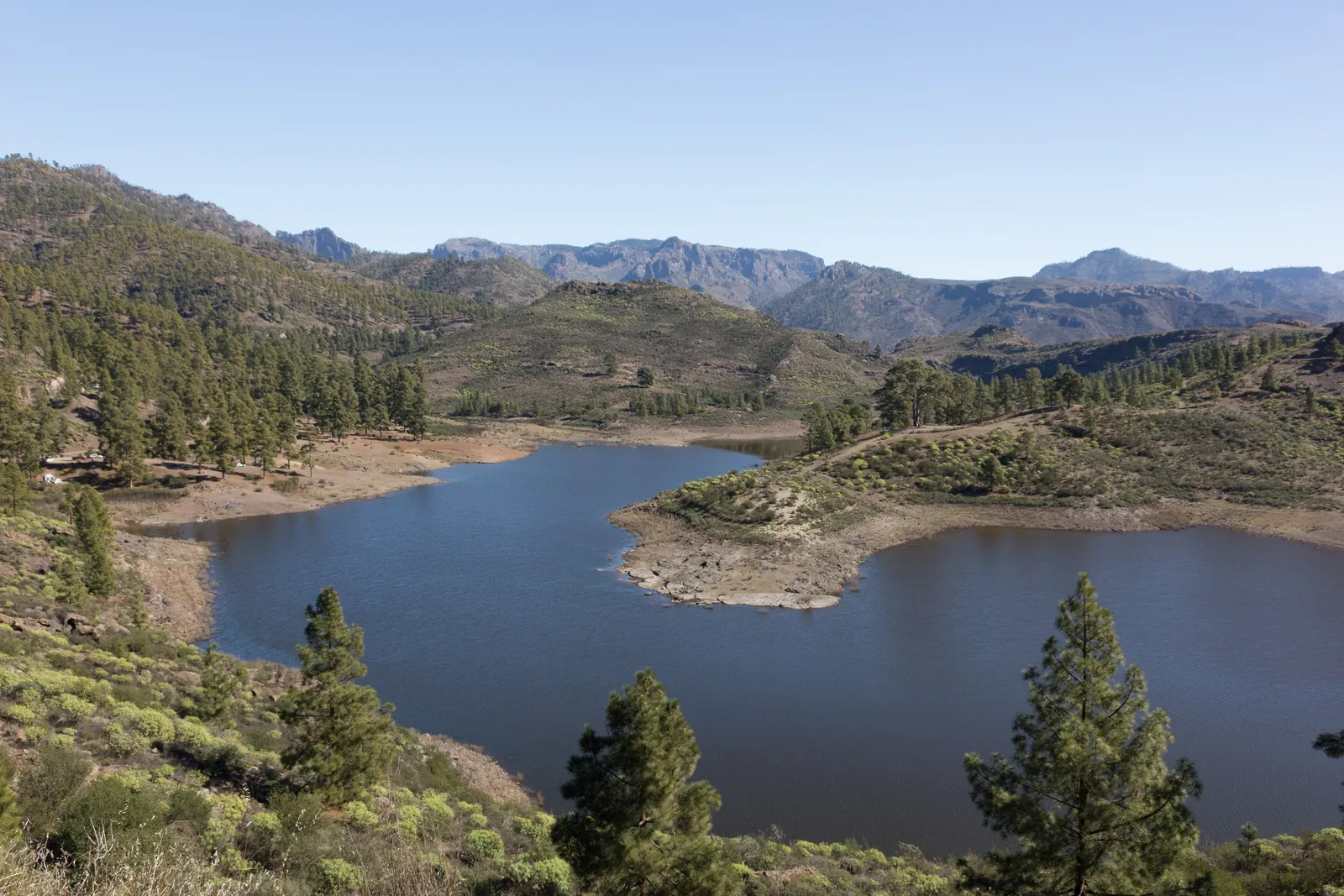
The GC-505 climbs from the coast road at El Pajar up the Barranco de Arguineguín to Cercados de Espino and Soria: 13 km and 21 minutes to the first, 24 km and 38 minutes to the second.
The Barranco de Arguineguín is the long ravine that runs inland from Arguineguín towards the middle of the island, and the road that follows it, the GC-505, is the way into the quiet interior behind the resorts. From the coast it takes about 21 minutes to reach Cercados de Espino (13 km) and about 38 minutes to Soria (24 km), by the routing service's estimate with no traffic. It is a drive of farms, small hamlets and a very large dam, and it is the nearest place to Arguineguín where the landscape is not the sea.
There is nothing in the valley that you must see, and that is part of the appeal. This page is for deciding whether to drive up, where the road goes, and what to do when you get there. The two villages have their own pages: Cercados de Espino and Soria and the Soria dam.
What the barranco is
A barranco is a dry stream valley cut by occasional heavy rain. This one gives Arguineguín its name, and it runs down to the sea beside the town. The catchment above is large (the basin behind the Soria dam alone is 32.5 km²) and it is dammed in steps: the dam at Soria is fed by overflow from the Chira dam through a tunnel and from the Las Niñas dam through the Majada Alta ravine, as well as by the barranco itself. Two municipalities share the valley: map data places Cercados de Espino in San Bartolomé de Tirajana and Soria village in Mogán, with the dam between the two.
The road: GC-505
The GC-505 branches off the coast road (GC-500) near El Pajar, where Global's line 6 lists a stop called "Cruce del Pajar (GC-505)". According to routing data, it then passes El Horno, and splits: one way to Cercados de Espino, and the other on through Las Filipinas to Soria. Treat this as the general picture and follow the road signs, because map data for small village roads is not always right.
| From Arguineguín to | By road (about) |
|---|---|
| Cercados de Espino | 13 km, 21 minutes |
| Barranquillo Andrés | 21 km, 32 minutes |
| Soria village and dam | 24 km, 38 minutes |
These come from a public routing service (OpenStreetMap data, no live traffic). It is a mountain road, so allow longer, and fill the tank in the coastal towns first. The Mogán council's tourism page describes the GC-505 as the road from the island's centre to the northern districts of Mogán.
The villages along it
Global's line 6 is a useful list of what is on the valley road. In order from the coast, its stops are Casas de la Cesa, Las Crucitas, Palmarete, El Sao, Peñones, Cercado de Espino, Campo Fútbol, Las Filipinas and Barranquillo Andrés. These are small clusters of houses and farms, not towns; Cercados de Espino is the one with its own page, and Soria is the one with the dam. Do not go expecting a mango trail: the council's eco-tourism material places avocado and mango growing mainly in the Veneguera ravine, not here.
The Soria dam
The Presa de Soria is the largest dam in the Canaries by height and volume. It was built from 1962 to 1972, it is about 120 m high, and its capacity is some 32 million cubic metres, though it has never filled: it is also the only dam on Gran Canaria that has never overflowed. It stands beside the village of Soria between the municipalities of Mogán and San Bartolomé de Tirajana. Details are on the Soria page.
Walking and cycling
The Mogán council has marked routes in this area. Route R8, from Barranquillo Andrés to Soria, is 10 km, about four hours, and rated moderate to high effort. The council warns that the start of the path and the Majada Alta area are poorly signposted and that some stretches are in poor condition, with loose earth underfoot, so it is not a route to try with no map. A longer one, R9, links Mogán village, Barranquillo Andrés, Veneguera and Soria in a 30 km macro-route. Our guide to hiking near Arguineguín puts these in context.
For bikes, Spanish rules apply: a helmet is compulsory outside built-up areas, and drivers must leave 1.5 m when overtaking. A rule change reported for 1 October 2026 should be checked on the DGT website. More in road cycling from Arguineguín.
By bus or by car?
By car, clearly. The only bus is line 6, which makes one trip a day each way: it leaves Casa Memo in Arguineguín at 06:30 and leaves Barranquillo Andrés for Arguineguín at 07:05, and Global classes it as a "taxi-guagua" service, so it is not a day-trip option (see the bus page). A hire car or a taxi is the realistic choice.
Viewpoints
Mogán's official list of viewpoints names El Mulato (over the Mogán valley, on the GC-605), Playa de Mogán, two at Puerto Rico and Veneguera, none in the Barranco de Arguineguín itself. If the valley appeals as a day out, you can combine it with Mogán village by road, but that is a longer day.
Frequently asked questions
Which road goes up the Barranco de Arguineguín?
The GC-505, which leaves the coast road near El Pajar. It leads to Cercados de Espino and on towards Soria.
How long does it take to drive to Soria from Arguineguín?
About 24 km and 38 minutes without traffic, by a public routing service. The road is a mountain road, so allow longer.
Is there a bus up the valley?
Only Global's line 6, once a day each way: 06:30 from Arguineguín and 07:05 from Barranquillo Andrés. It does not work for a day out.
How high is the Soria dam?
About 120 m. It is the largest dam in the Canaries by height and volume, built between 1962 and 1972.
Can you hike in the Barranco de Arguineguín?
Yes. The Mogán council's route R8 runs from Barranquillo Andrés to Soria: 10 km, around four hours, moderate to high effort, with poor signposting at the start.
Sources
- Global: line 6 stops and times (Casa Memo to Barranquillo Andrés)
- Mogán tourism office: route R8 Barranquillo Andrés - Soria
- Mogán tourism office: route R9 macro-route
- Mogán tourism office: viewpoints
- Mogán tourism office: how to get there (roads)
- Wikipedia (Spanish): Presa de Soria
- iAgua: Soria reservoir data